GREEN CONNECT
Charlotte, NC (Spring 2018)
Molly Stahl, Kelsey Morrow
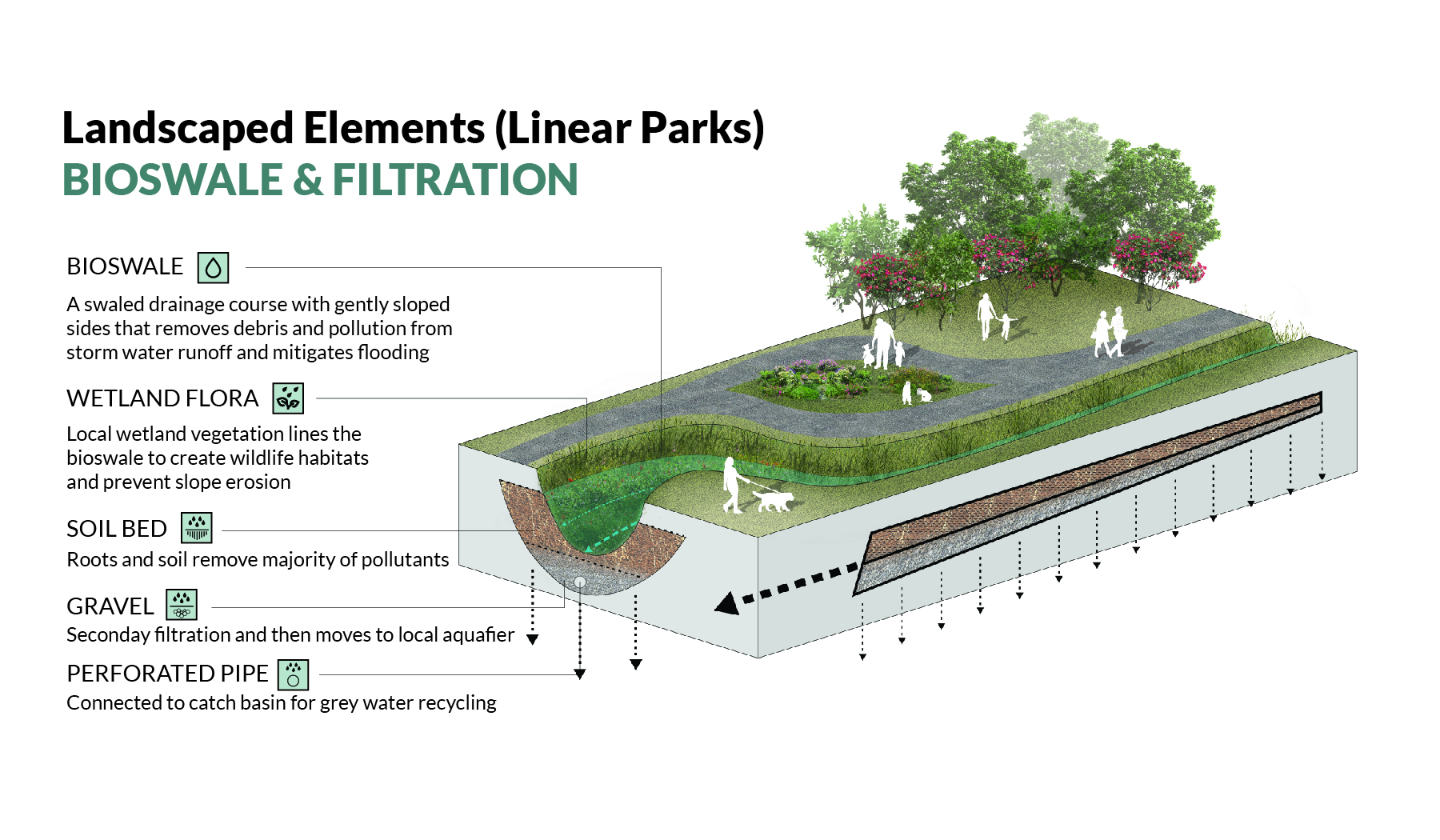
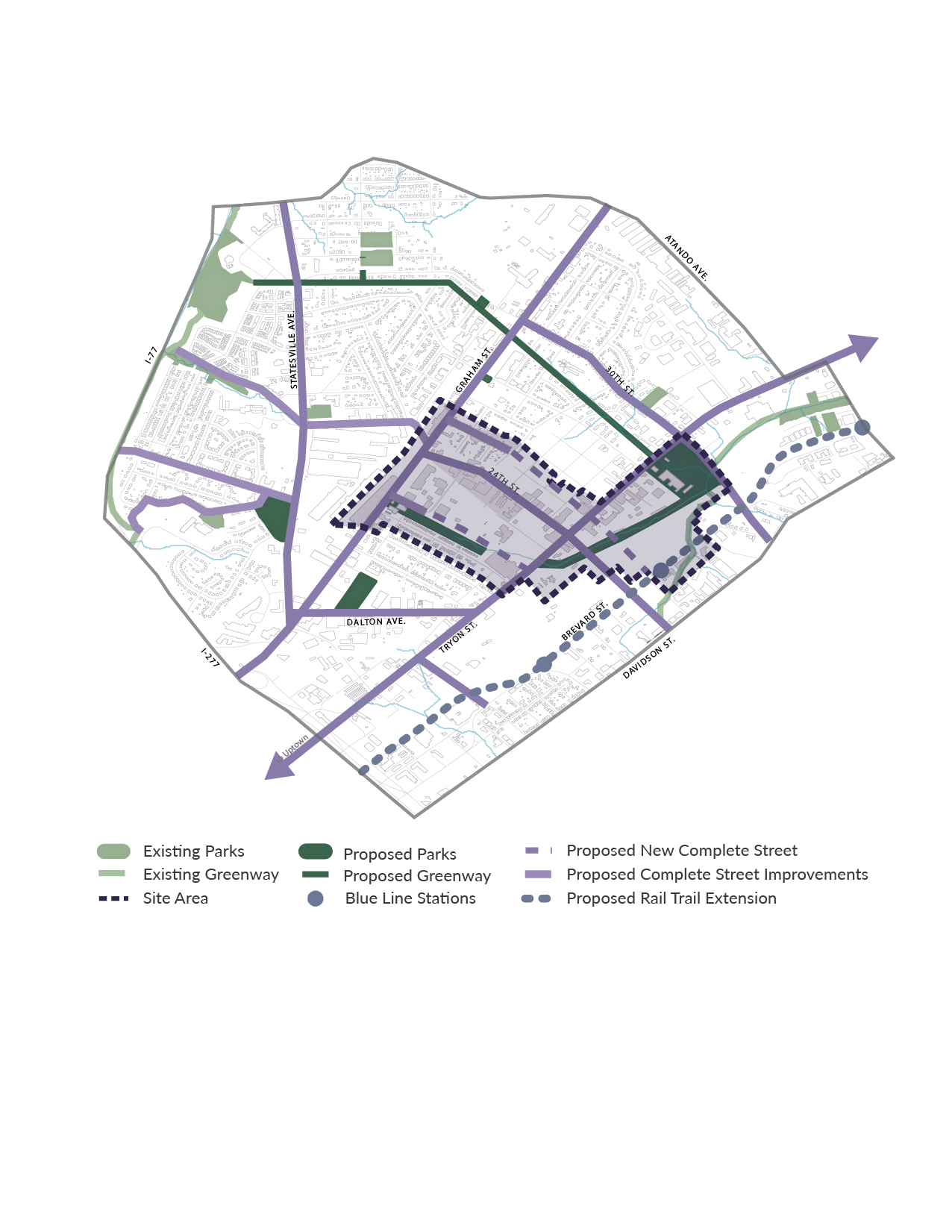
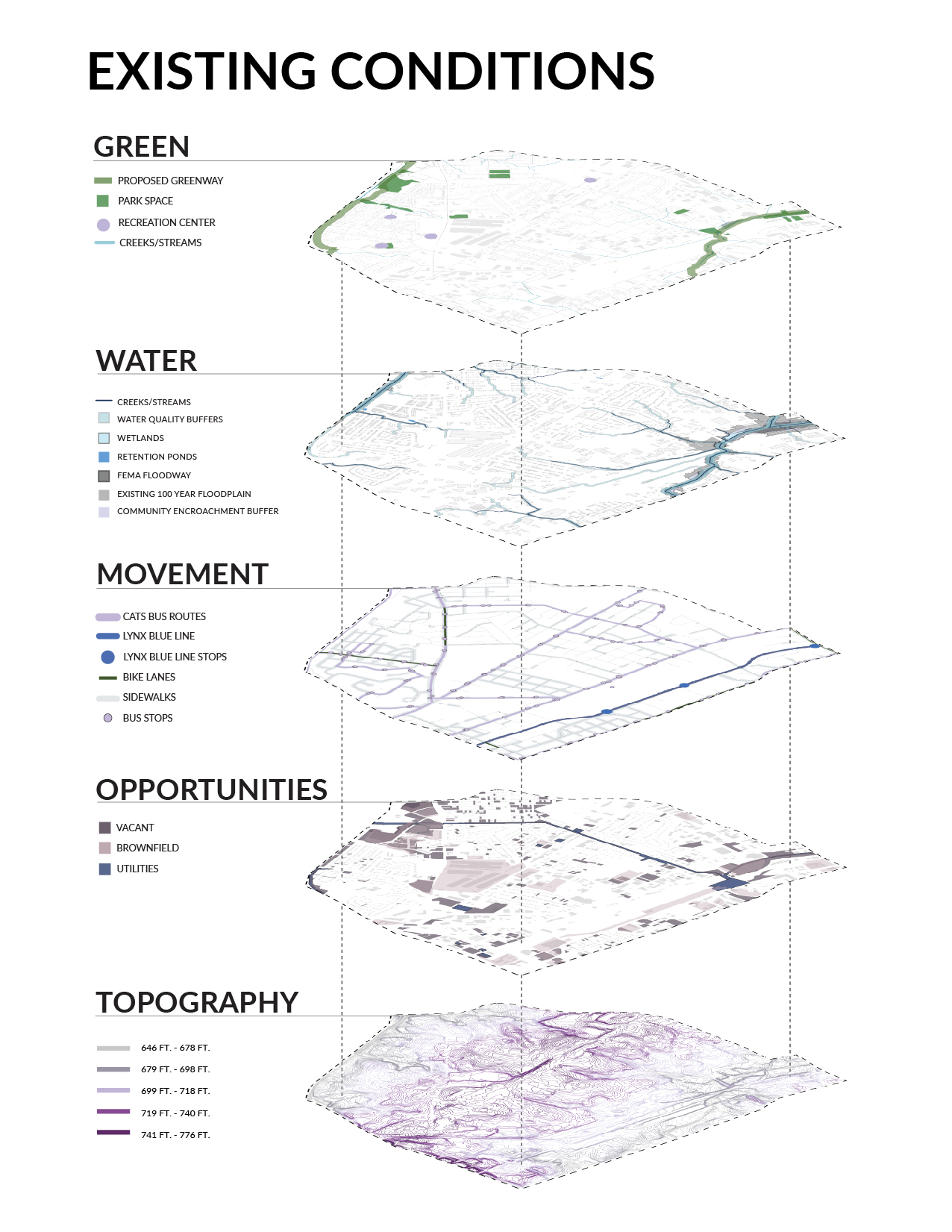
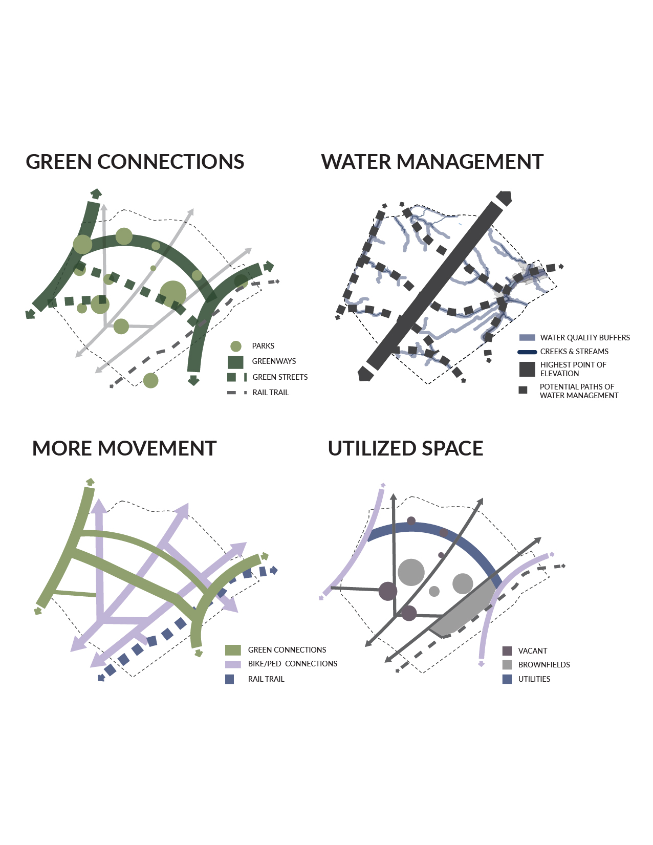
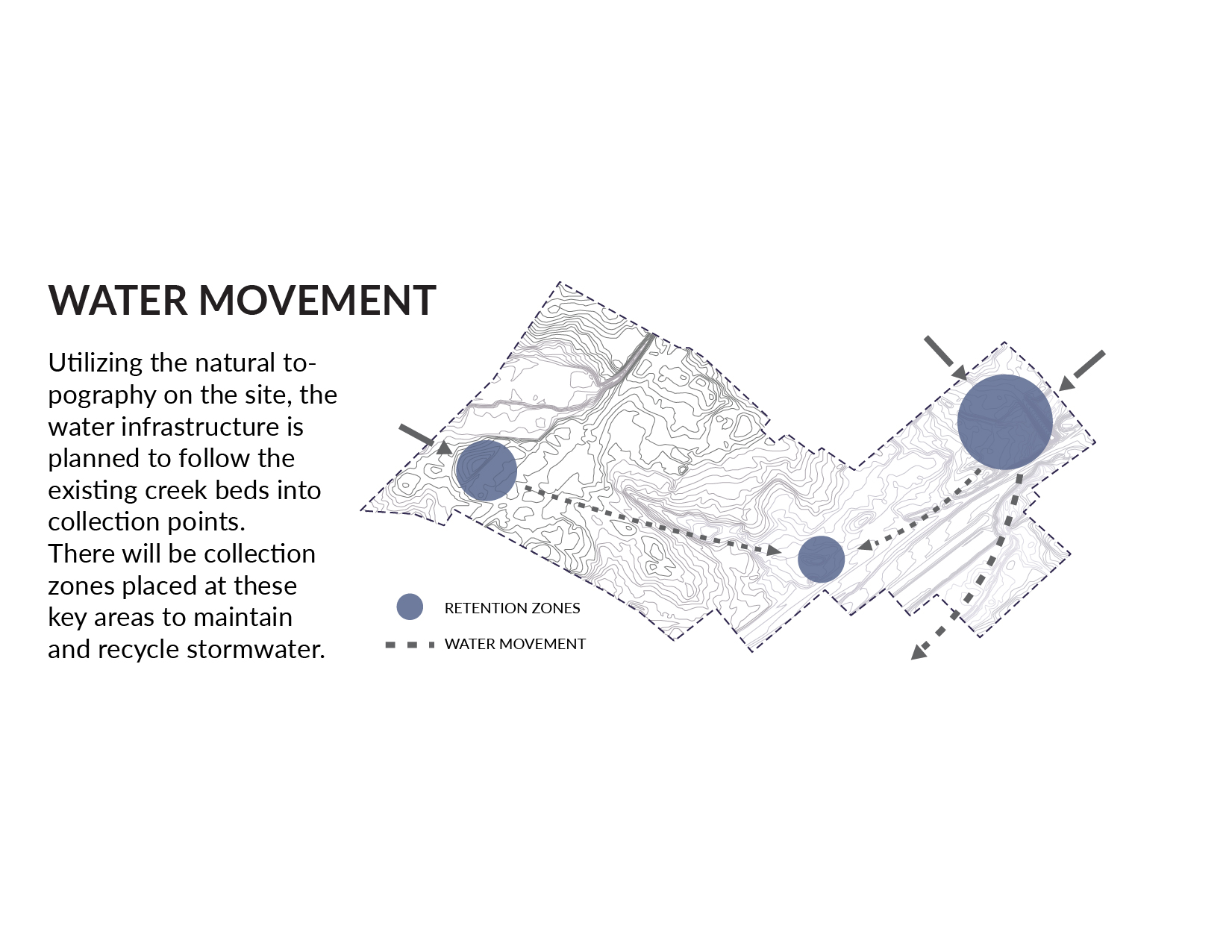
The North End Smart District currently has very minimal green space, with green-way extensions planned for the northwestern and southeastern boundaries of the site. Our design for a green network for the district includes green-way extensions, green streets, linear parks, and a series of other green spaces guaranteeing easy-access to open and natural space for every resident. The network makes use of vacant parcels and brown-fields, while utilizing the site’s natural topography to better manage storm-water.
Total Site: 300 Acres | Linear Park (Programmed): 3.5 Acres | Linear Park (Natural): 5.5 Acres | Wetland Park: 24 Acres | Total Green Space: 40 Acres
THE VISION
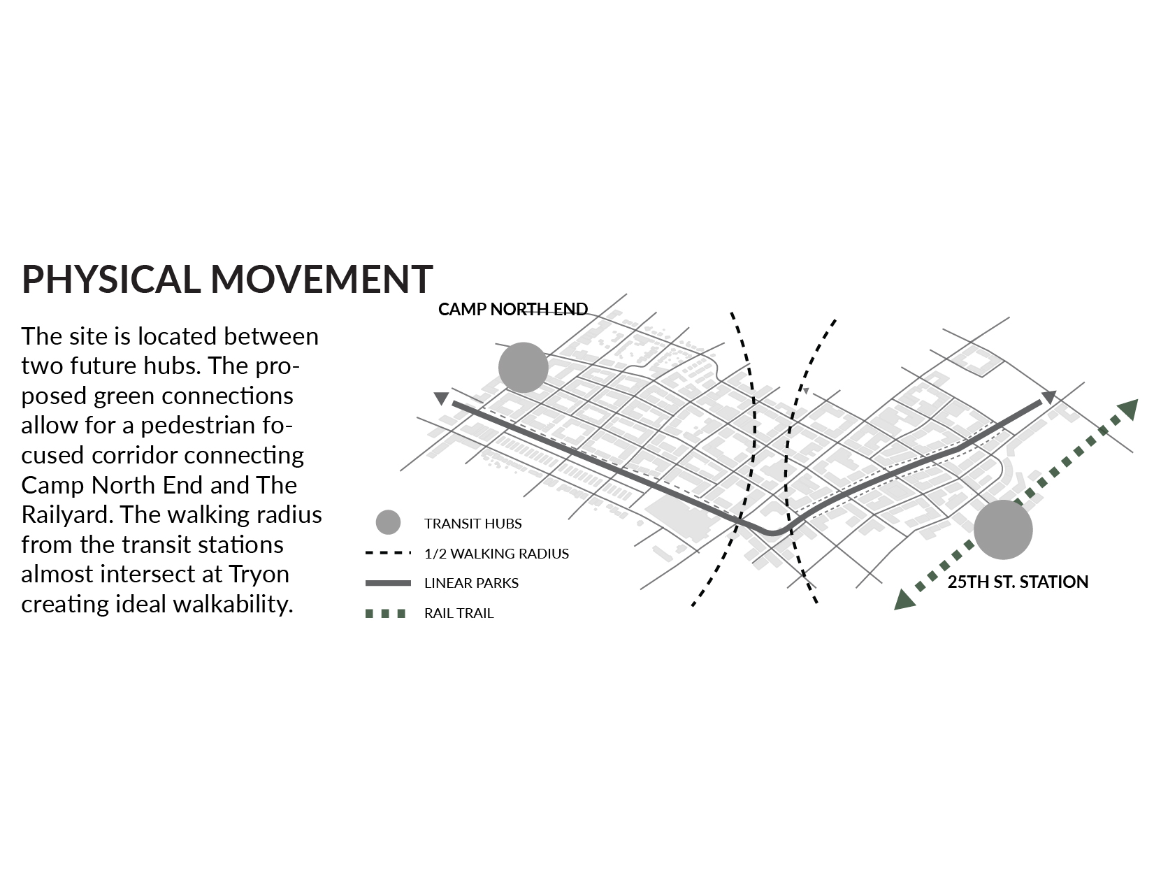
Creating a green connection from the future commuter rail station in Camp North End to the existing 25th St. light rail station, the site design utilizes its natural topography along with “smart city” elements to improve water management, while supporting an urbanized transit-oriented built environment. With over thirty-five acres of natural and open space, opportunities for recreation and physical activity are plentiful, benefiting both public and environmental health.
SPATIAL FEATURES
FORM BASED CODE
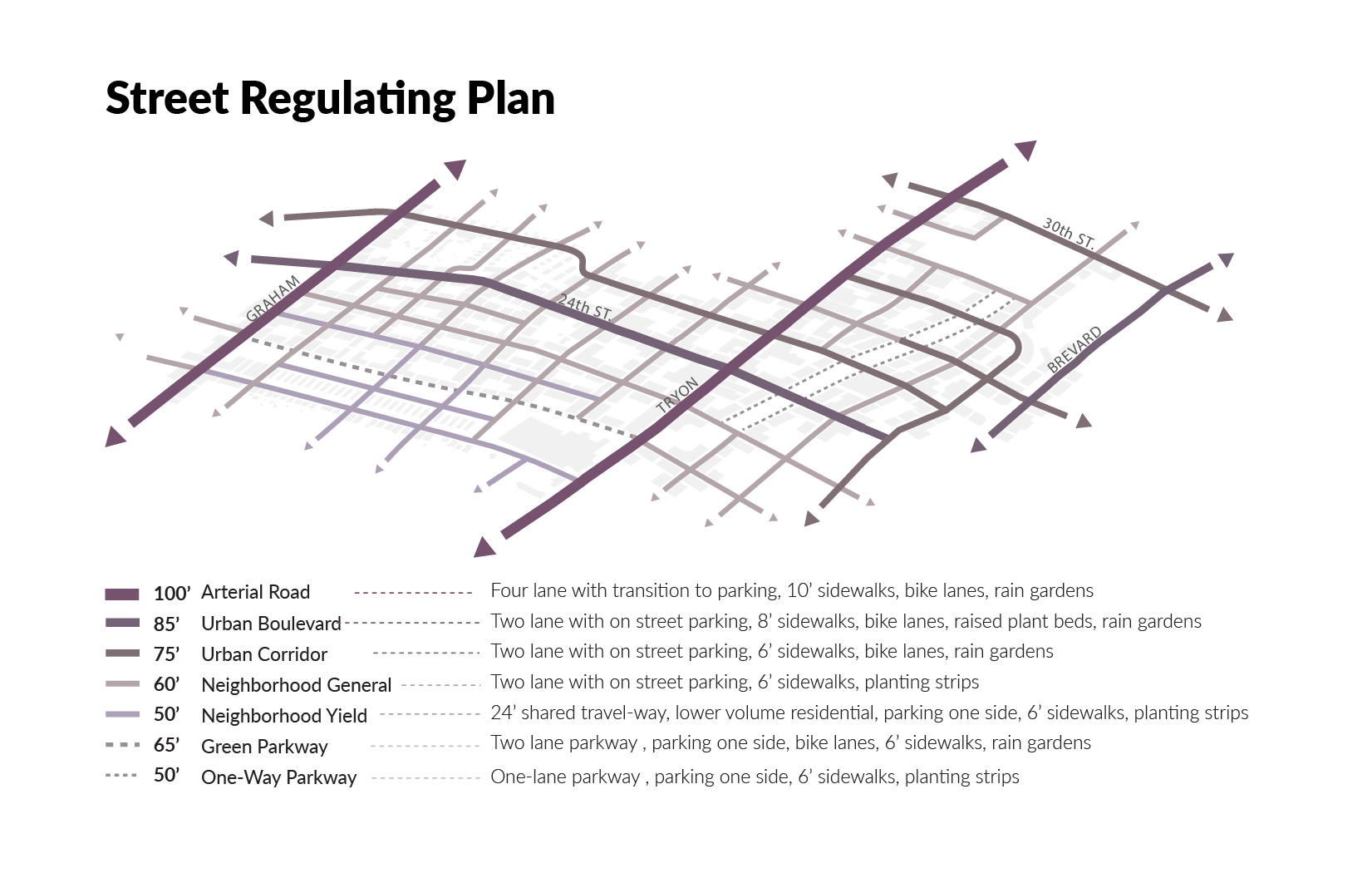
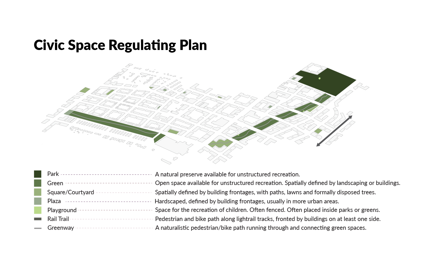
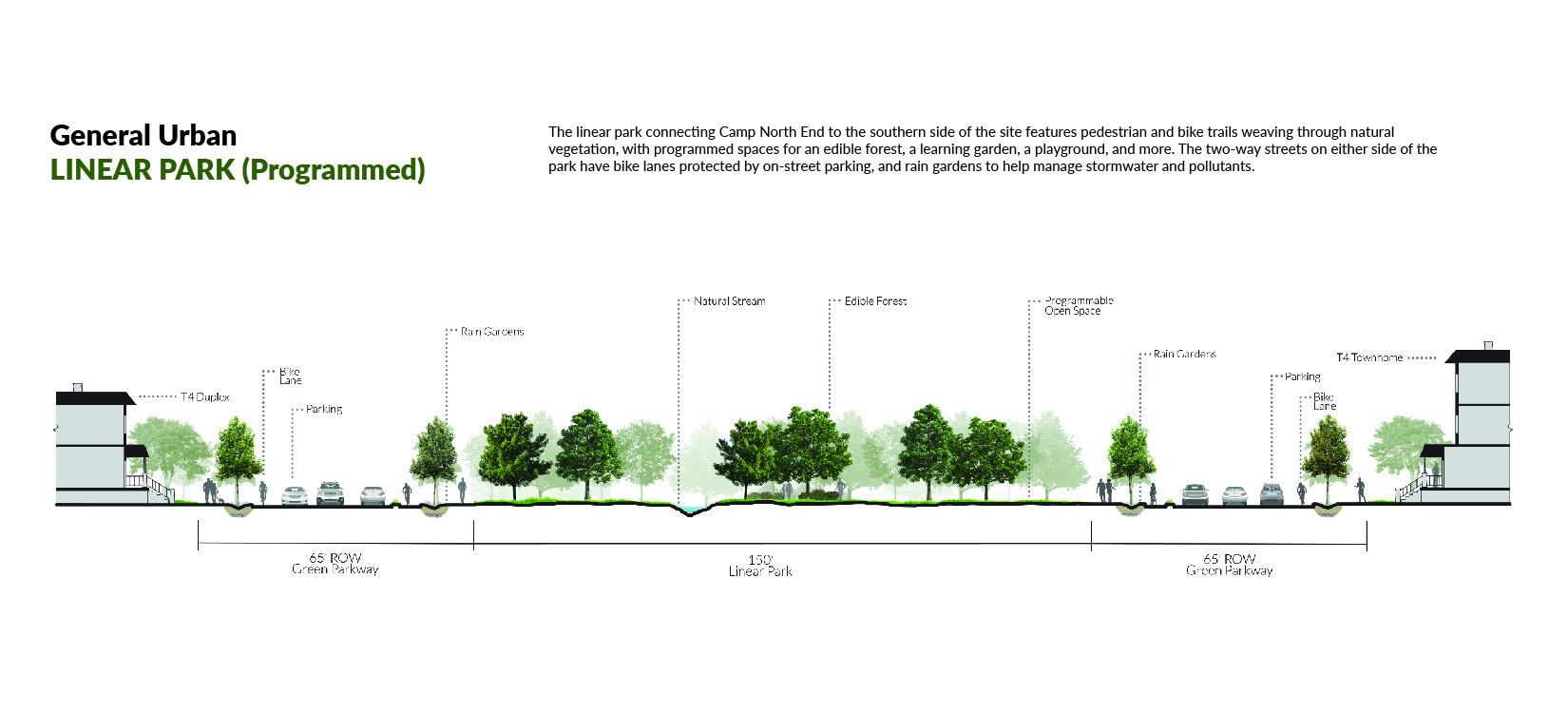
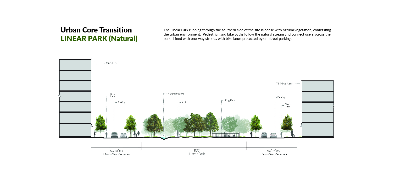
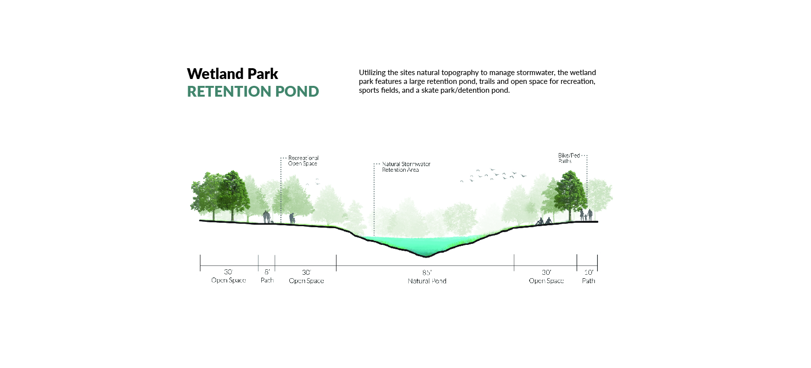
The linear parks feature pedestrian and bike paths that run along a natural stream, surrounded by a combination of open, natural, and programmed spaces. The twenty-four acre wetland park at the northeastern edge of the site creates a connection with the Sugar Creek Greenway and features large water retention zones, open recreation space, and sports facilities while preserving natural vegetation and wildlife habitats.
Camp North End: The Linear Park entrance, located on Graham Street adjacent to Camp North End, features a hard-scaped plaza surrounded by mixed use buildings. The central area of the plaza utilizes the site’s water recycling infrastructure and highlights a splash pad as its’ focal point.
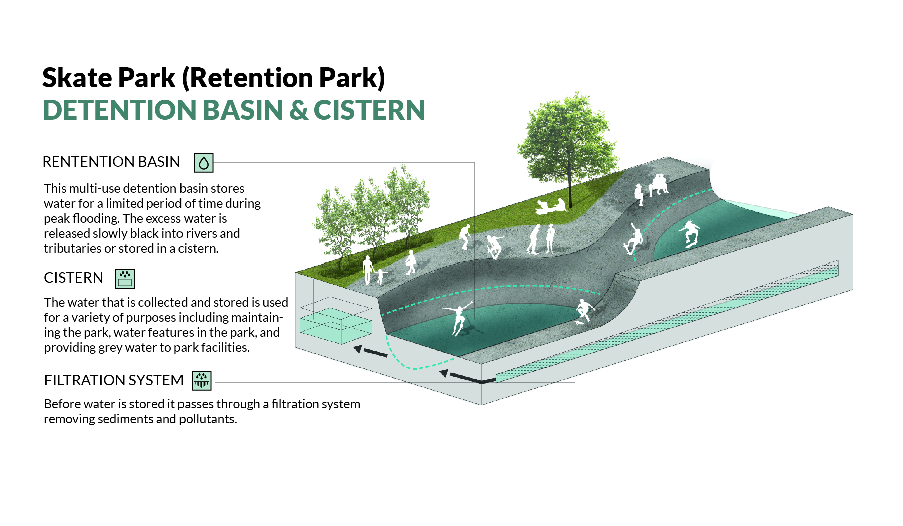
Wetland Park: Utilizing the site’s natural topography to manage storm water, the wetland park at the northeastern edge of the site features a large retention pond, with trails and open space for recreation. The natural vegetation allows for preserved and improved wildlife habitats.
The proposed Rail Trail extension through the site creates a vibrant outdoor space that promotes active transportation usage, while providing space for public art installations.
As part of the North End Smart District, the site utilizes many “smart city” strategies and technologies including grey-water recycling, stormwater retention, rain gardens, wifi and charging stations, data collection sensors, and bike share and repair stations.
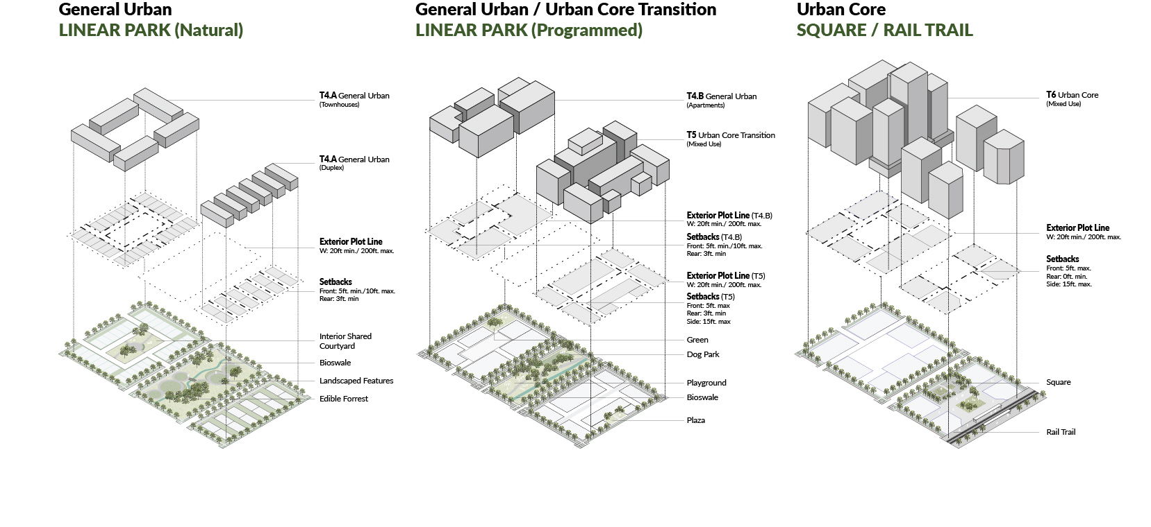
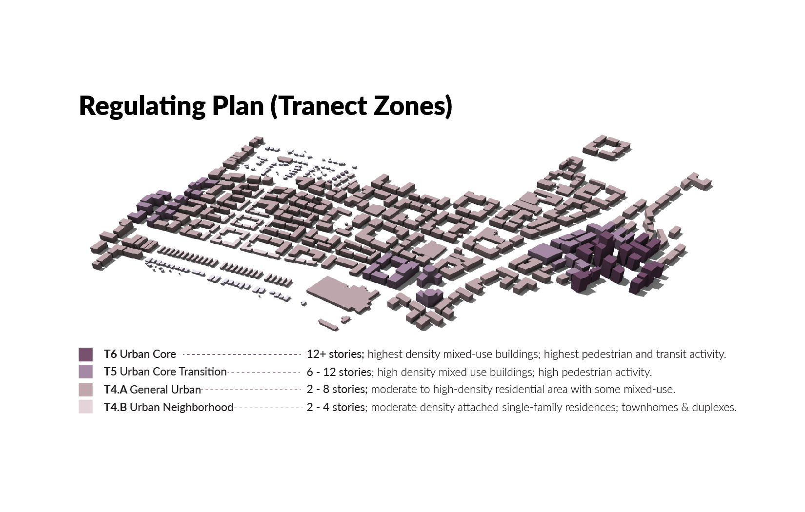
Using a form-based code to design the built environment, the site is made up of four different transect zones (T-Zones) ranging from a moderately dense residential zone (T4A) to a highly densified urban core centered around the light rail station (T6).


